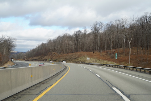
The Pennsylvania Turnpike may be 80 years old, but its GeoAnalytics program is leveraging geographic information to drive the future.
When the Pennsylvania Turnpike opened almost 80 years ago it was the nation’s first super highway and provided a way for people to drive from one point to another faster than they ever had. Today, as you are stuck in traffic, it may be easy to forget what a revolution that was.
Today, new consumer apps for phones have gained huge popularity because they crowdsource accident and traffic information from people on the road so that drivers behind them can be routed around trouble spots. They are using data to improve the driver experience.
Yet that original architect of the superhighway is also working with data and technology to make the travel experience better and safer. The Pennsylvania Turnpike Commission is dispatching state police and emergency crews after an accident, clearing the roads after an incident, performing snow removal, and scheduling roadwork. Thanks to the geographic information experts at the commission, now there’s an app for that, too. At least there is in Pennsylvania.
Actually, it’s more like a whole host of applications, backed by data and infrastructure created by a geographic information systems team at the turnpike commission, using technology services from GIS vendor Esri, and working with the commission’s 80 years of data. Although analytics programs have been in place for years, the official project to turn geographic information into internal products that can be used by the multiple departments within the turnpike commission — called GeoAnalytics — is only a little more than a year old. But it already has changed how the organization can leverage geographic information.
GeoAnalytics Information Officer Kenneth Juengling told InformationWeek that an early use case for the geographic information was a web mapping application for incident data, including accidents that happen along the turnpike. Information about incidents came from state police, which in many cases are co-located with turnpike commission facilities. The project allowed the tracking of incident hotspots, a valuable early proof of value for the GeoAnalytics project. On the momentum of that and other projects, the Turnpike Commission launched the formal GeoAnalytics program in December 2018.
“We’ve grown quickly from next to nothing,” Juengling said of the GeoAnalytics program. “We’ve done a lot with the organization to engage our business areas, to explore what the technology can do with the mindset of ‘try, fail early, fix it,’ to prove it to senior executives.”
Career GIS consultant Rob Marsters, now a senior project manager for GeoAnalytics, arrived at the commission right about when the program was launching.
“One of our main clients here is the traffic operations center,” he told InformationWeek. “It’s this huge room with so many screens. We are monitoring everything that is going on.”
There are incoming calls, traffic cameras, and weather alerts and current conditions, among other data, too. The screens include live views of traffic cameras, along with dashboards and visualizations. When any incident happens, it generates a computer-aided dispatch, or CAD, with the right teams to respond to the specific issue — towing companies, state police, and others. The goal is real-time event detection, because every second counts in an emergency situation. Marsters said that a new integration with navigation and traffic app Waze has now provided a 3- to 4-minute advance notice of incidents.
The three-person team leading the GeoAnalytics program includes Marsters, Juengling, and business intelligence expert Dave Ward, along with about 15 contractors. It is creating the foundation for a number of applications that can be used by the PA Turnpike Commission’s many departments including traffic operations, engineering, and maintenance. All together the Commission’s 1,900 employees are responsible for 552 miles of roadway from Ohio to New Jersey, 83 interchanges, 17 service plazas, 5 tunnels and 1,360 bridges.
One of the applications of GIS in the winter months includes location data from devices in the turnpike’s fleet of vehicles, which tracks the roads that have been plowed and the roads that need to be plowed.
Another application is Deer Encounter. Just like the name, this one collects data about specific incidents of cars hitting deer along the turnpike. The team has been able to generate heatmaps of these types of encounters, allowing visualization of where the most encounters have happened. Through this application, the team could also see that November is really the peak season for deer encounters with 752 of them in November 2019. Part of that is probably due to the rutting and hunting seasons, Marsters said. But the GeoAnalytics team has enabled the commission to take a closer look at areas of heavy activity to investigate other causes. For instance, close to Valley Forge the commission found that there was a water source on one side of the Turnpike and an orchard, or food source, on the other side. Now engineers are able to investigate ways to reduce the risk in this area.
The GeoAnalytics team is looking ahead to other projects, too.
One priority is to improve enterprise data management, answering the questions that naturally come with that such as who owns what data and what are the standard operating procedures.
Another initiative is in an application for staff mobile devices that enable staff to see CAD (computer assisted dispatch) events.
Staff can look at a map, see backlogs, look at incidents, plus get information about police, ambulance and fire services. In addition, the team is adding the ability to take over the cameras on devices in order to record visual information about incidents.
All of this goes back to the turnpike commission’s mission: “To operate a safe, reliable, customer-valued toll road system.”
Jessica Davis has spent a career covering the intersection of business and technology at titles including IDG’s Infoworld, Ziff Davis Enterprise’s eWeek and Channel Insider, and Penton Technology’s MSPmentor. She’s passionate about the practical use of business intelligence, … View Full Bio
More Insights


Leave a Reply